ONLINE-PUBLIKATIONEN
Die hier zusammengestellten Arbeiten verschiedener Verfasser beschäftigen sich mit unterschiedlichen Aspekten der Anwendungsmöglichkeiten von QGIS und sind teilweise eigens für Numismatik in Hannover erstellt worden. (uw)
Originalbeiträge
- Jan Steffens, Die Auswertung von digitalen Geländemodelldaten in QGIS (2022)

- Ulrich Werz/Anke Matthes, KMZ-Dateien in QGIS 3.x einbinden und bearbeiten (2022)
Links
- Breier, Markus: GIS for Numismatics – Methods of Analyses in the Interpretationof Coin Finds. In: Kriz, Karel et al., Mapping Different Geographies (Berlin/Heidelberg 2010) 171-182
Abstract
This paper investigates the use of geographical information systems (GIS) in numismatics. Up to now,geographical information systems are rarely used in numismatics, although neighboring disciplines likearchaeology take advantage from adopting this technology and science. Some of the methods the archaeologistsuse can be applied in numismatics as well. The basis for every GIS application is geo-referenced data. The paperhas a focus on numismatic data and its fitness for use in a GIS. Data from the Austrian coin database dFMRÖserves as an example. The limitations of this dataset concerning accuracy and precision, which are not up to thestandards desired for usage within a GIS, will be highlighted. Subsequently the effects of data quality on theresulting models will be estimated. Predictive site modeling and least cost paths serve as examples.
- Breier, Markus: GIS in der Numismatik – Analysemethoden in der Interpretation von Fundmünzen, Diplomarbeit Universität Wien (Wien 2009)
Abstract
The Interpretation of coin finds is a sub discipline of numismatics, which deals with the scientific description of coin finds and hoards, especially their function and its occurrence in space and time. Although function and occurrence in space and time are clearly geographic attributes, up to now this special field of cultural historic research is only rarely taking advantage of the strengths and opportunities which GIS can offer. This paper investigates the suitability and application of methods proprietary to geographic information systems (GIS) in context with numismatics. One focus is on the situation of numismatic data and its fitness for use in a GIS. In archaeology, which to a large part is dealing with the dispersal of research objects over space and time, the use of GIS is very much approved by scientists and already widely spread. Archaeologists adopted GIS early in its development, thus there are proven and comprehensive methods for the use of GIS in archaeology. Some of the methods the archaeologists use can be applied in numismatics as well. The aim of the analyses is the modeling of areas of circulation of Roman coins in Styria by the means of GIS software. Predictive site modeling is a method for predicting possible places of finding in previously not sampled regions based on the properties of known places of findings. Least cost path analyses can be used to find the most probable route on which the coins were imported to a specific area, especially in the more remote regions. These methods of analyses demonstrate the potential of the use of GIS in numismatics.
Zusammenfassung
Ein Teilgebiet der Numismatik (Münzkunde und Geldgeschichte) untersucht das Vorkommen und die Funktion von Münzen in Raum und Zeit. Trotz dieser deutlich geographischen Fragestellung werden in dieser Disziplin bis jetzt geographische Informationssysteme (GIS) kaum bis gar nicht benutzt. Diese Arbeit geht der Frage nach, wie sich geographische Informationssysteme in der Numismatik, speziell bei der Interpretation antiker Fundmünzen, nutzen lassen. Es wird dabei auch die Situation der Geodaten in der Numismatik beleuchtet und die Auswirkungen auf den Einsatz von GIS berücksichtigt. Ausgangspunkt für die Analysen und Modelle ist die Erfahrung der Archäologie mit GIS. Da die Archäologie ähnliche Fragestellungen wie die Fundmünzennumismatik behandelt, können Methoden, die in der Archäologie üblich sind, auch in der Numismatik angewandt werden. Für diese Arbeit wird einerseits die Frage nach weiteren potenziellen Münzfundorten gestellt, andererseits wird versucht, zu bestimmen, wie Münzen in entlegene Gebiete gelangt sind. Die Antworten auf diese Fragen werden zur Bestimmung von Zirkulationsgebieten benutzt. Dafür wurden vorhersagende Fundortmodellierung (predictive site modelling) und least cost paths als Analysemethoden ausgewählt, die zeigen sollen, dass GIS in der Numismatik eingesetzt werden kann.
- Kristina Neumann/John Wallrodt, The Third Side of the Coin: Using Google Earth to Visualize Numismatic Data, Digital Clasics Online 3-3, 2017, 37-60
Abstract
This article presents one digital approach to ancient numismatics. The proposed methodology maps geo-referenced quantities of coin finds within the platform of Google Earth – a free virtual globe available through the Internet. Especially for the uninitiated scholar, Google Earth efficiently visualizes both the spatial and chronological distribution of thousands of coins and provides an intuitive and interactive space for exploring regional and empire-wide patterns in their movement.
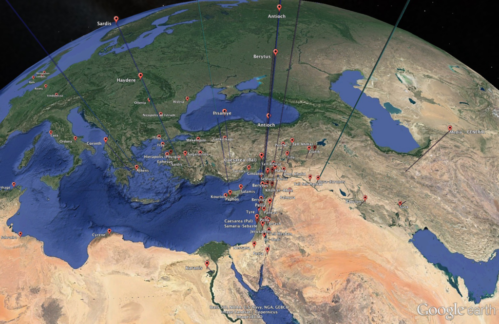
Illustration 1: A screenshot of geo-referenced quantities of coin finds in Google Earth Pro. While the practical applications of this methodology are many, this article focuses on an ongoing study of Antioch-on-the-Orontes in northern Syria and its regional evolution after Roman annexation. This project draws upon Google Earth as an invaluable first step in synthesizing the wealth of disparate coin data available for the city. After outlining the methodology to achieve such a visualization, this article highlights several promising patterns revealed by Google Earth in the dataset.
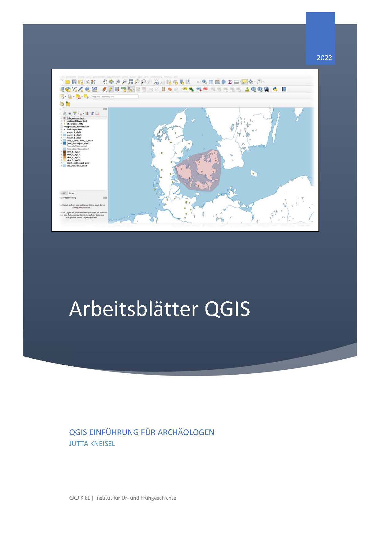
- Kneisel, Jutta: Arbeitsblätter QGIS (Kiel 2022)
Cover
< zurück zu QGIS für Numismatiker und Archäologen